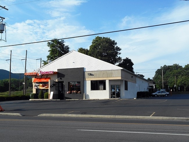
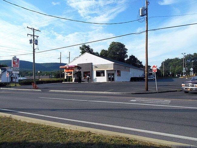
Property Record
435 Blue Valley Dr, Bangor, PA 18013

NEARBY LISTINGS FOR SALE OR LEASE
Property Detail
435 Blue Valley Dr
Storebuilding
Northampton
X
Pennsylvania
42095C0155E
1.06 AC
2025
Lehigh Valley
2025
Philadelphia
015300
Allentown-Bethlehem-Easton, PA-NJ
4,084 SF
D9-15-15A-0134
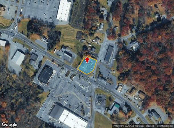
DEMOGRAPHICS near 435 Blue Valley Dr
1 Mile
3 Mile
5 Mile
2024 Total Population
3,906
18,196
28,586
2029 Population
3,969
18,399
28,769
Pop Growth 2024-2029
+ 1.61%
+ 1.12%
+ 0.64%
Average Age
44
41
43
2024 Total Households
1,546
7,227
11,437
HH Growth 2024-2029
+ 1.68%
+ 1.25%
+ 0.77%
Median Household Inc
$67,406
$69,913
$70,053
Avg Household Size
2.40
2.50
2.40
2024 Avg HH Vehicles
2.00
2.00
2.00
Median Home Value
$221,899
$213,679
$236,569
Median Year Built
1954
1950
1960
Nearby Places
Map Layers
Map Styles
 Street
 Aerial
- Restaurants
- Banks
- Shops
- Fitness
- Groceries
PUBLIC TRANSPORTATION
AIRPORT
Lehigh Valley International
DRIVE
WALK
Distance
Lehigh Valley International
41 min
25.8 mi
SALE & LEASE HISTORY
LISTING DATE
SALE/LEASE

Sep 25, 2016
For Lease
Jun 06, 2022
For Lease
Nearby Properties
Address
Land Use
TOTAL SIZE
Lot Size
Zoning
Address
Land Use
TOTAL SIZE
Lot Size
Zoning
42,140 SF
33.11 AC
R10
Address
Land Use
TOTAL SIZE
Lot Size
Zoning
104,971 SF
20.30 AC
A
Address
Land Use
TOTAL SIZE
Lot Size
Zoning
6,200 SF
345.07 AC
FF
Address
Land Use
TOTAL SIZE
Lot Size
Zoning
87,926 SF
20.76 AC
R2
Address
Land Use
TOTAL SIZE
Lot Size
Zoning
63,477 SF
16.68 AC
C
Address
Land Use
TOTAL SIZE
Lot Size
Zoning
73,531 SF
1.44 AC
GB
Address
Land Use
TOTAL SIZE
Lot Size
Zoning
7,704 SF
1.78 AC
R78
Address
Land Use
TOTAL SIZE
Lot Size
Zoning
34,781 SF
167.39 AC
FF
Address
Land Use
TOTAL SIZE
Lot Size
Zoning
3,440 SF
6.73 AC
IE
Address
Land Use
TOTAL SIZE
Lot Size
Zoning
43,744 SF
10.12 AC
C
Address
Land Use
TOTAL SIZE
Lot Size
Zoning
20,608 SF
4.77 AC
R10
Address
Land Use
TOTAL SIZE
Lot Size
Zoning
92,438 SF
19.14 AC
FF
Address
Land Use
TOTAL SIZE
Lot Size
Zoning
674.77 AC
E
Address
Land Use
TOTAL SIZE
Lot Size
Zoning
22,430 SF
35 AC
R2
Address
Land Use
TOTAL SIZE
Lot Size
Zoning
17,500 SF
2.90 AC
IL
Address
Land Use
TOTAL SIZE
Lot Size
Zoning
28,688 SF
79.34 AC
GI
Address
Land Use
TOTAL SIZE
Lot Size
Zoning
295.87 AC
OSC
Address
Land Use
TOTAL SIZE
Lot Size
Zoning
72,160 SF
12 AC
R2
Address
Land Use
TOTAL SIZE
Lot Size
Zoning
72,160 SF
12 AC
R2
Address
Land Use
TOTAL SIZE
Lot Size
Zoning
20,339 SF
2.46 AC
R10
Address
Land Use
TOTAL SIZE
Lot Size
Zoning
9,000 SF
11.75 AC
IE
Address
Land Use
TOTAL SIZE
Lot Size
Zoning
280.40 AC
W
Address
Land Use
TOTAL SIZE
Lot Size
Zoning
15,777 SF
15.57 AC
IE
Address
Land Use
TOTAL SIZE
Lot Size
Zoning
118,318 SF
1.58 AC
IL
Address
Land Use
TOTAL SIZE
Lot Size
Zoning
24,000 SF
4.25 AC
C
Address
Land Use
TOTAL SIZE
Lot Size
Zoning
18,892 SF
3.23 AC
R1
Address
Land Use
TOTAL SIZE
Lot Size
Zoning
4,700 SF
8.36 AC
IL
Address
Land Use
TOTAL SIZE
Lot Size
Zoning
33,841 SF
1.24 AC
R1
Address
Land Use
TOTAL SIZE
Lot Size
Zoning
9,900 SF
36.77 AC
R2
Address
Land Use
TOTAL SIZE
Lot Size
Zoning
30,302 SF
3.03 AC
R1
The World's #1 Commercial Real Estate Marketplace
Connect with us
© 2025 CoStar Group
The information above has been obtained from sources believed reliable. While we do not doubt its accuracy we have not verified it and make no guarantee, warranty or representation about it. It is your responsibility to independently confirm its accuracy and completeness. Any projections, opinions, assumptions, or estimates used are for example only and do not represent the current or future performance of the property. The value of this transaction to you depends on tax and other factors which should be evaluated by your tax, financial, and legal advisors. You and your advisors should conduct a careful, independent investigation of the property to determine to your satisfaction the suitability of the property for your needs.